Racing Plain 100M+ in 2009
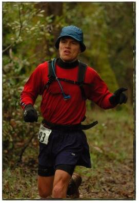
Last week I had the pleasure to meet up with a group of ultra runners for the 2009 Plain "100M" race. I met with Beat J at the airport and we drove for a couple of hours to arrive at the race central at the Thousand Trails Lodge in Plain, WA.
Plain is a back-to-basics race, and quite a contrast to WS100 I did earlier this summer. There are no medical checks, no television crews, no long lines, no crowds, and just a small team of crew members. However, the race has tremendous charm, with home-cooked pre-race dinner, a family-style race briefing, and a warm relaxing atmosphere. The nearby Search-and-Rescue (SAR) team takes care of runner safety and handles timing.
Plain is not a "beginners" 100M race (if such a thing even exists). This race has no trail markings, no pacers, and only 1 aid station (at 55 miles); and as a bonus adds an extra 5+ miles beyond the formal 100M course thus coming in at approx 105M total. The course itself is demanding, if not brutal, in several aspects - crossing over 3 peaks at 6000-7000ft, and several sections of rough and exceedingly steep trails - for total of more than 21,000 feet of climb and same coming down. Competitors that choose to run at Plain need to be confident to handle a wide variety of trail conditions, besides carrying all food and essentials needed during the race. Water can be found in streams, and as I personally found out - requires "active" planning to ensure sufficient hydration at all time.
On race morning start was at 5AM, and the field sprinted off in the darkness. I joined up with Michael Popov at the front of the field, and together we chased a single runner up in front. We passed Deep Creek at furious pace after just 14 minutes, and turned up the hill towards the Maverick Saddle. Here the road climbs steadily, and we kept a solid pace at the front of the pack. After checking the map we found the correct turn to the left on a smaller rough gravel road. I reached the SAR check point after 1:19 hrs, and Michael joined me a couple minutes after. Together, we rounded the hill and turned off to a small road leading down/left. After a few minutes this connects to the Mad Lake Trail single track. We continued running at good speed, and could not hear or see anyone following us anymore. After approx 10 minutes we came to a trail crossing, where the course turns sharp left up a faint almost overgrown trail. The trail is steep, and even walking is tough at some sections.  The climb continues for 20 or so minutes, and then leads to rolling trail along the ridge line. This is a very runnable section, but the trail is cut out by water and motorcycle tracks in a few places and I had to jump around to avoid the largest gaps.
I stopped to refill my water bottles, and Michael caught up with me and did the same. As we fixed our gear, 2 other runners passed by. We continued a steady climb and up to and across several very pretty lakes and alpine meadows. This section was very cold in the morning and I wished I had brought some thin gloves (especially when running with 2 hand bottles filled with ice cold water).
The trail eventually comes to a trail crossing to North Tommy Trail, where it is important to turn right to get up to Klone Pk. This is really the only place on the first lap where it is possible to pick the wrong trail. A small trail then leads up to the top of Klone Pk - the views are amazing.
I was at the top (at approx 6600 ft) at 9.12 AM in the morning. I had another granola bar, and put on my ipod. the run down from Klone Pk to the next SAR check point is mostly a nice soft downhill, including a section of almost zig-zags. This is a great section to keep up a nice pace, and I passed a couple of runners who were going slower. The trail empties out to a gravel road, passes the SAR check point, and leads to an asphalt road. Running on the asphalt road was tedious, and by now the heat was increasing so I tried to stay in the shade where possible. This is also a very runnable downhill section - just very boring. After approx 20-30 minutes the road leads to a turnout area, with a trail leading down left towards the creek. This section is narrow, downhill, runnable but dusty and somewhat technical. At the bottom of the hill (at approx 2050 ft) I met the race directors Chris and Tom who where picnicking and watching the runners come by. I turned right the trail leading up the hill, and crossed the bridge over Tommy Creek after a few minutes.
During the race pre-briefing they had informed us that the next 14 or so miles had no water, and I had brought a couple extra water bottles (besides my hand bottles) for this reason. However, I had misread the map, believing that there was another creek further up the hill - and therefore I only filled my hand bottles, so to try avoid carry unnecessary weight up the hill. The hill is brutally steep and goes on for ever. After climbing for an hour, my water now was gone - and I realized that there would be no more creek higher up. I thought for a moment about returning back down to fill up water, but quickly decided this would be a bad idea. I kept hoping there must be SOME place to find water higher up. The climb continued upwards, and after 2 hours I could see Signal Peak high up in the sky. As I continued the climb up to the peak I now had been running 1.5 hrs without any water and really started to feel weaker. The trail passes several smaller false summits, and the last part up to the highest point (at approx 6500 ft) is extremely exposed to sun since all vegetation is gone due to some forest fire in previous years. Finally the trail turns downwards, and passes through some more tree covered sections. I went off the trail to look for some possible water sources - but all was bone dry, so I decided to just keep going - knowing that I would have at least 7 miles remaining to the next known water source. I had never run so long without any water in any race or in training - so I was wondering what the effects would be for the race overall, and even if I would ultimately would get water - how long it would take for my body to recover from the added stress during these dry 2-3 hours. At one point the trail rounded a small greenish meadow - and I realized this may be a unexpected opportunity to find some water. There was no clear running water to be seen, but I jumped out in the high grass and walked out into the middle of the meadow to find a very small stream. I filled every water bottle I had and also drank over a liter of water right on the spot. Life was back, I took some salt tablets, and some food - and got back on the trail and was able to pick up the speed running at nice speed. I passed by the SAR check point, and dropped off 10 hours worth of empty GU packages and CLIP-2 bags.
The section leading down to the river crossing is  very demanding, it is steep down hill, and has much loose rocks, and is also overgrown with weeds and bushes. But it is worth the price - as the water in the stream is superb and refreshing. I again filled up all bottles, and continued onwards on a rolling climbing trail up to Maverick Saddle. This section of the trail is amazingly pretty - with dense vegetation, and many magical small waterfalls along the narrow creek canyon. I finally reached the top of the trail, and after checking the the map I came out back at Maverick Saddle. I felt surprisingly good, and was relieved to have completed much of the first lap of the course. I knew the next 4 or so miles were mostly downhill on a relatively easy mountain gravel road. I ran all the way down to Deep Creek to complete the first lap at approx 13.5 hrs. I had hoped to come in below 14 hrs so I felt all was per plan so far. The volunteers informed me I was in 4th place - which felt great.
The volunteers at Deep Creek did an amazing job and were super helpful. I changed clothes and shoes, swapped to my night backpack, and was served some nice hot pasta.
In 5-10 minutes I was off on the trail towards Alder Creek.  I found this section of the trail quite tedious, I was able to run large parts of it, but there are never ending small hills that break up your rhythm and the trail zig-zags in and out of the woods in the a convoluted way. I passed Alder Creek after a couple of hours, and as the evening was coming I took out my headlamp and continued onwards in a mix of running/shuffling/walking.
After another hour the trail narrows and climbs steadily up along Chikamin Tie Trail. The trail is very steep in some sections (although not as sustained as up to Signal Peak). It was now pitch dark, and I had not seen another person for almost 4 hours. I felt OK physically, but sensed I was getting in somewhat of a zombie mode mentally as I continued grinding up the hill. An hour later, as I was refilling my water bottles, I met a skunk(!) blocking the trail. The skunk clearly had no intention to move, and I certainly did not want to get "skunked" - so I hurled a few pine cones and twigs at him, and he ultimately decided to disappear out into the dark woods. As I kept running on, I was passed by another runner. I figured that 5th place was still fine, and I should just keep up the forward speed, A little further on he stopped to fill his bottles, and I passed him. Another hour later the trail turns up to the right (this is one of the few places where it is possible to miss a turn on the second lap). This led to a longer than expected sustained climb up to the next SAR check point. At first I could see some headlamps following me in the dark, but they faded away and I did not see any other runner for the next couple of hours.
The section of the trail that climbs up to the top of the peak (at approx 6300 ft) and then comes around the Pond Meadows was extremely tedious. The trail is just a single narrow motorcycle tire width which makes running difficult and painful for the feet. As I came down past the meadows I was passed by another runner. It was late at night and it now was getting chilly. I stopped at Mad Lake and put on my windbreaker, only to have to take it off 15 minutes later when as I started the climb up Alder Trail. From the pre-briefing I did not realize this was a climb - I had assumed it was all downhill from Mad Lake...
At the crest of Alder Trail my headlamps started to get dim, it was still another hour until proper daylight - so I ran in semi darkness for a while. Then follows a steep endless zig-zag downhill. I ran most of this section, but it was mentally demanding as it felt it would never end. Finally, the trail spit me out on a gravel road, and after a short section of single track there is a couple of miles on a wide gravel road leading down to Alder Creek trail crossing. As I came down to the main trail intersection I passed the same runner I had met a few hours earlier up at Mad Lake during the night. As I stopped to fill up water, he continued on and sprinted away out of sight.
Now having done all the hard parts of the course, I was considering how fast I should run the final 7 miles. I felt it would be great to go under 29 hrs, and thus picked up a decent pace of walking uphills and running the flat and downs. After the next 3 or so miles, I realized 29 hours was safe, and I decided to get as close as possible to 28 hrs. I passed Deep Creek at 28.02 hrs, and then just had the 1.7 miles left to the Finish. A volunteer at Deep Creek told me I was in 4th place. This information made me realize that I had a chance to make a solid result at this race. I immediately started to worry someone would come and pass me in the last 15 minutes of the race - so I ran the whole section as fast as was possible, stopping at each turn to check that no one was coming after me... (Later I found that the next closest competitor was more than an hour back, but the stress definitely helped me sprint the last part of the race).
Crossing the finish line in approx 28.20 was wonderful and met my goal of finishing in between 28 and 30 hrs.
In summary, Plan is a superb challenge and an excellent race for those that enjoy a more back-to-basics adventure-like race.
Note: Pictures in this blog are reused from Glenn Tachiyama's great write up of his training runs for both lap 1 and lap 2.
My official time at SAR check points
| Maverick | 1:19:05 |
| Tommy | 5:41:00 |
| Tyee | 10:14:10 |
| Maverick | 12:35:34 |
| Deep Creek | 13:14:45 |
| Chickamin Tie | 19:53:00 |
| Alder Cr. | 27:18:00 |
| Finish | 28:21:02 |
Summary of Trail conditions (scroll down to see the information!)
| Section | Distance | Grade | Width | Trail | Water | Other |
|---|---|---|---|---|---|---|
| Start - Deep Creek | 1.7 | Gentle | Wide | Road | No | Dark |
| Deep Creek - Maverick Saddle | 7.0 | Steady up | Wide | Road | No | Dark |
| Maverick Saddle to Hi-Yu Trail | Rolling | Single track | Trail | Yes | ||
| Hi-Yu Trail | Steep up | Narrow | Trail | No | Overgrown | |
| Ridge Line past Lost Lake | 11.7 | Rolling | Single track | Trail | Some | |
| Meadows at Blue Creek Trail | Steady up | Single track | Trail | Some | Very cold | |
| North Tommy Trail to Klone Pk | 20 | Steady up | Single track | Trail | No | |
| Klone Pk - SAR (FSR 5605) | 26.6 | Rolling/down | Single track | Trail | No! | |
| SAR down on road | Down | Wide | Road | No | ||
| South Tommy Trail down to Creek | 30 | Steep down | Single track | Trail | Yes | Dusty |
| Over Bridge and half-way up the hill | Steep up | Single track | Trail | No | Very steep | |
| Halfway up to Signal Pk | 36.6 | Steady up | Single track | Trail | No! | |
| Signal Pk to SAR | Rolling/down | Single track | Trail | No!! | ||
| SAR to Cougar Creek | 44.3 | Rolling/down | Narrow | Rocky! | Finally | Brutal Overgrown |
| Cougar Creek to Maverick Saddle | 49 | Rolling/up | Single track | Trail | Yes | |
| Maverick Saddle to Deep Creek | 55 | Steady down | Wide | Road | No | Gravel road |
| Deep Creek to Alder Ridge Trl | 62 | Rolling | Single track | Trail | No | |
| Alder Ridge Trl to Chikamin Tie Trail | 65 | Rolling/up | Single track | Trail | Yes | Darkness coming |
| Chikamin Tie Trail to SAR | 74 | Steady up | Single track | Trail | Plenty | |
| SAR to Pond Camp Trail | 80 | Steady up | Single track | Trail | Yes | Rocky sections |
| Pond Camp Trail to Pond Meadow | 84 | Rolling/up | Narrow | Trail | No | Tedious |
| Pond Meadow to Alder Ridge Trl | 87 | Flat/up | Single track | Trail | Yes | Chilly |
| Alder Ridge Trail down zig zag | Steep down | Single track | Trail | Some | Technical | |
| Road all down Alder Ridge Trail | 97 | Flat/down | Wide | Road | No | Gravel road |
| Alder Ridge Trail to Deep Creek | 103.3 | Rolling | Single track | Trail | No | |
| Deep Creek to Finish | 105 | Flat/down | Wide | Road | No | Gravel road |