Sunday, October 01, 2006

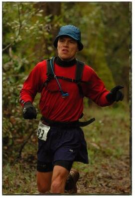
Rio Del Lago 100M - Yeah!


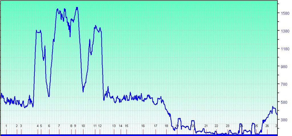
Sweet success - I completed my first 100M run! Last weekend I was able to complete my first 100 miler, beating challenging conditions. The whole week before I had been battling a persistant cold with stuffy nose and head. To make matters worse I had to fly to London on a quick turn business trip, not returning until Friday morning in San Francisco. I was worried the long travel and resulting jetlag would make the cold even worse - but I proved to be unstoppable :-)

Race start early Saturday morning from Cavitt School yard.
The first hour is spent on rolling hills on gravel bike roads along the American River. I was glad I brought a headlight, several other runners had skipped their light - and had to stumble around in the dark for the first section. I led the field for the first 5 minutes...I contribute it to having a good headlamp.

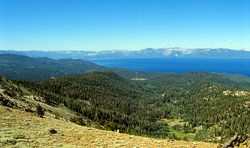
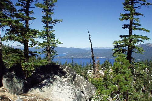
After 45 minutes or so, the trail narrows to a single track hiking trail along the shore line, very runnable and with just minor elevation changes. The trails can be rocky in places twisting around every corner as it continues north. Trail markings were Ok but definitely not superior - if there was one suggestion to Norm for next year - then it would be to put some more effort on the markings.

I passed by a couple of aid stations and filled up with some bananas and water - but generally just kept going for the first couple of hours. After just over 2 hours the trail starts climbing over a few smaller hills, only to suddenly hit the steep Heartbreak Hill that climbs from 500 ft to 1400 ft in less than a mile - power hiking is the only way to get up.


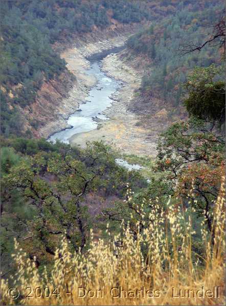
There is an aid station half a mile after coming up the hill, and I finally was able to fill up on fluids - advice for next year is to bring 2 bottles from 3rd aid station since the section to up after the hill is quite long.

I came into the Overlook aid station at 3.20 feeling in good shape. This was the first weight check and I was doing OK. I had learned my lesson from TRT and started drinking earlier in the run. I dropped my headlamp and running top since it was already getting warmer. I continued down along the WS100 trail, decending quickly for another 4 or so miles to aid station No Hands Bridge at 4.25.

Then the trail climbs back continuously for the next hour arriving at Cool Fire station at 5.20. The following section was the most tedious part of the race, with the course doing a loop around the grassy fields, along dirst roads, passing across a couple of creeks, to return back to Fire station at 6.30 - a bit boring and very hot. Remember to bring a lot of water for this section if it is a hot day and this can be a good section to do some power hiking to recover from the earlier climbs.


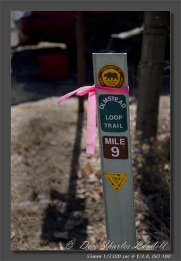
The run down to No Hands Bridge was relaxing and quite fun to make good distance and to get some shade among the trees. The trail markings were a little sketchy at time - it is good to study the map in advance for this section. Over the Bridge and then back to Overlook aid station at 8.44, I dont remember the trail was so steep...I power hiked some of the steeper sections here. At the aid station I swapped socks, and loaded up on some energy bars and fluids. During the early parts of the race I had suffered from some stomach troubles and this had continued for the last few hours, but it finally started to stablize which made me feel better about fluid intake and not having to jump into the bushes any more... The temperature had been around 60 degrees at start but would be around 90 degrees for much of the day - making for warm conditions.

The run along the drainage canal is nice and easy, then hits the steep downhill at Heartbreak Hill, back down to the river level. This time I was prepared for a lengthy part until next aid station - so I had loaded up with extra fluids and more - arriving at the aid at 10.20.

The trail back to the Cavitt School was nice running, I was very happy with the pace I was able to maintain - running on flats and downs, and power hiking all ups. The run had started going down, and my headlamp was in my dropbag at Cavitt School - but the last 30 minutes was in more or less complete darkness, luckily this section is bike trails to running and route finding is very easy. I called home to let my family know everything was going great and all was fine this far.

I arrived back at Cavitt School after 14.10 (i.e., at 8.10 PST). The aid station here was great, warm soup, helpful volunteers, I got my iPod, new socks, and changed to bigger shoes, and put on a light wind jacket. My personal goal for this run was to complete my first 100M, second goal was to do it without injury, final goal was to try do it in 25 or so hours. At this point in the race I was really happy with how thing had been going and I was confident I would be able to complete the remaining 33 miles in less than 15 hours (to make the 30 hr cut off). During my Tahoe Rim Trail I did a lot of power hiking during the second lap on that 50M course and I decided to do the same for the remaining part of the RDL 100M race. I figured that even if I only walked all the way it would not take me more than max 10-11 hours to complete.

The following section is very easy terrain - flat and mostly on bike trails and gravel roads. The aid stations are well placed 3-4 miles apart, and less in some cases. After 17.40 I arrived to the main aid station before the trail drops down across the main bridge over the river. I had drop bag at this aid station - and I also grabbed some nice hot soup. At this point I had started feeling a little tired and drowsy - but kept power hiking at good speed all along.

After the aid station the trail circles down/under/over a bridge/road/bike trail to come out on an easy dirst trail continuing along the bike trail and road leading towards the turn around point at around 83M. I reached this at a few minutes around 2 AM after racing for approx 20 hours. It was great to sit down - I had some extra soup and tried hold on to the energy. This was the longest I had every run straight so it great feeling, and I was certain I would make this 100 miler - but also knew there was quite some distance still to go (16 miles...).

After the turn around I started meeting many of the other racers, most of them were 30 minutes or an hour or more behind. I did not feel any worry they would catch up - since I didnt care much now that I knew I would be able to complete my own race. I continued - the aid stations were great, helping with soup and encouragement, and after the second to last aid station the sun started coming up and I was able to turn off my headlamp. I was really glad with the performance of the lamp, I used rechargeable AA batteries and they did a good job during all of the night. My time for mile 67 to 83 and from mile 83 to mile 100 was virtually the same - so I was holding a very steady pace during the night. The last few miles passed slowly - but finally I arrived back at the finish line at Cavitt School - after 25 1/2 hours of racing. It was a great feeling. I was very tired - but maybe more by lack of sleep than a complete physical exhaustion. I believe the fact that I walked the last 11 hours allowed my body to stay relatively fresh throughout the last 3rd part of the race. In future races, as I want to break 24 hours, I will need to run a portion of the last section.

Conclusion: Rio Del Lago is a great first 100M race. It certainly is a challenge, but the easy terrain in last part of race make for it a doable race if one just keeps going. The logistics is good with easy access for pacers and friends. Race director Norm is doing an excellent job, volunteers are helpful and truly amazing.

Friday, August 18, 2006

Tahoe Rim Trail - first 100 M run

I participated in the TRT 100M race in July. This was my first 100 miler, and ultimately I was not able to complete the full distance, however it was a great experience and I learned a lot. This is a blow-by-blow summary of the run.


Friday July 14th: Early on Friday morning I drove up to Tahoe, to arrive to the runner check-in at noon. I stayed at the Plaza Hotel down town in Carson City. After weigh-in and regular medical, there was a runner orientation meeting where race directors walked through all the practical details of the race for all participants. I spent the rest of afternoon eating and relaxing. Carson City was very hot - an indication of what was to come the following day.

I had a hard time falling to sleep that night, in anticipation for the race next day. Wake up call was early around 2.30 am to get a solid breakfast in time for the start at 5 am. It was a dark morning - but the race organizers had done a great job preparing the starting area with clear markings and lights. The race kicked off and I got a good start, and actually led the field for much of the first 2 miles. I had decided to run without headlamp in the early morning so I stayed close to other runners for this section.

The course soon started climbing and then din a steady go up reaching Marlette Lake after approx 40 minutes. The course continued on forest roads, over a few steep rolling hills up to the first aid station. I filled my bottles and continued on the trail now leaving the forest road onto single track. Now the sun had come out and no light was needed. The trail crossed a few patches of snow as it continued climbing. The next stretch was very runnable with gradual climbs and nice trail. After another 45 minutes the trail reached a highpoint and started descending to the Tunnel Creek aid station. A seemingly never ending series of switch backs lead down to a flat area where the aid station is. I reached this after approx 2 hours.

I filled up my bottles and continued down the Red House Loop. This section is the lowest elevation point on the trail and is known to be challenging. This certainly proved to be true - the trail is rough, with sandy stretches, rocks, rough gravel, and long sections that are very steep. At this point I was running at around 4th place in the race, with some faster runners having passed me just before the first aid station. I actually enjoyed the Red House Loop, if one can enjoy something like this, it made for fast and exciting running. The climb up from the fluids-only aid station at the bottom of the loop was a steady grade and very runnable - arriving back to the Tunnel Creek aid station again at approx 3 hrs.


I left the aid station quickly and continued up towards Mt Rose - this is a beautiful part of the trail, following along the crest of the ridge line for much of the next 9 miles. At this point the day had started heating up and I was glad to reach the fluid-only aid station at the half-way point. The trail kept climbing slowly up towards the Mt Rose aid station at 26.5 miles. The last section was a little muddy, required jumping puddles and a few streams. I finally reached the aid station, did the medical check and weight check. I was down a couple of pounds so I reminded myself to watch my fluids as the day was getting even hotter. After refilling my bottles with ice and sports drink I started off down the trail again.

The way back to Tunnel Creek was nice - the steady decline made it quite runnable and I continued at good pace, and at this point I was probably in 6th place or so. I reached the aid station after approx 7 hours. At this point I was feeling some tightness in my left leg so I decided to get help some stretching/massage from one of the volunteers - this helped a little. The following climb up from the aid station was quite demanding, and my pace had slowed to a fast hike. Now it was mid-day and the heat was intense and so I was drinking continuously to keep my weight in order. I mixed walking and jogging for the next 5 miles until reaching the foot of the last major climb - the last push up to the Snow Valley summit. This turned out to be quite demanding, and I fast walked most of this section since it was steep and it reaches over 9000 ft elevation.

After the long climb it was great to arrive to the aid station at the summit - the volunteers were superb. I had continued loosing weight so I stayed here for an extra 5-10 minutes while I drank and ate to get back some weight. After a second weight check I filled up bottles with ice and started down the last long descent to the Start/Finish area. A long section of downhill with many switchbacks offered easy running and I could keep a nice pace for most of it. I arrived at the 50mile point at 10.40, a time I was happy with – especially considering the elevation, the climbing, and the continued heat.

The aid station at the start/finish was a busy place with many volunteers and friends waiting for their runners. I sat down and was served a big bowl of pasta, and I changed to fresh set of running shorts/shoes/socks/shirt. I also got my night gear out, and iPod.

I left the aid station after approx 10 minutes and started out the second lap. This definitely was a bit of a mental challenge, and having just finished a big meal I walked the trail for the next 2 hours until I got to the following aid station. At this point I started a slow jog up the trail, and I met quite a few stragglers from the 50 mile and 50K - who had DNF their races.

At this point I had passed my previous distance record at an official race (55 miles) so this was new territory, both physically and mentally - but I was keeping a steady pace and was feeling quite OK, arriving to Tunnel Creek aid station at around 7 PM. I left my night gear at the aid station and continued down the Red House Loop. This time the running was significantly harder and pesky mosquitoes made it less enjoyable. I walked the uphill at a steady pace and arrived back to Tunnel Creek at around 9 PM - right as I had planned.

The volunteers had made some pasta which I devoured while putting on head lamp and a light wind jacket as the air was getting a bit chilly. I started back on the trail - with 9 miles to go to next stop at Mt Rose. It quickly got darker and after 30 minutes I could only see the next 10-15 feet ahead on the trail. It was a quiet night without any wind - so conditions were perfect for night running.

This 9-mile section turned out to be surprisingly demanding. After a couple of hours I started to fade and my previously fast pace had slowed, and at around 11 PM I was feeling quite tired - and hoping to see the aid station soon (although I should have known it was still quite a bit left). I believe the reason for the increased tiredness was due to me eating too little during the night portion, something I now have learned for my next long race. As I got closer to the aid station I met the race leaders and the few runners coming spread out after him - at this point I estimate I was at around 10th place overall. Except for the lead runner - all the other runners had pacers helping them through the night. I had no pacer - and I now understand how helpful it is to have a person helping during the night - especially mentally.

During the last slog up to the aid station I got really tired, and I was looking forward to resting for a while. The volunteers were great and helped me with anything they could think of. At this point I felt very very tired - a feeling I had not felt before, and that is hard to describe - but then I mentally made up my mind that this was it for me that night. I felt good with 50 Miles at 10.40, and also good I had done 77 miles in 19 hours - so I called it a day. The remaining 23 miles may seem relatively short now - but sitting at the aid station in the middle of the night it felt too far away…

Some volunteers helped me back to my car, together with 2 other runners in similar situation. I felt really good physically, but looked forward to a nice rest and some food to regain my strength.

Overall, this was a really good race, well organized, excellent marked, great volunteers, and a demanding course to say the least - but with beautiful views during most of the way. Highly recommended.

I will be back next year - to do the full distance.

JF

Some other TRT100 stories:

http://hurthawaii.blogs.com/2006TahoeRimTrail100MileRunRodBien.pdf

Saturday, July 08, 2006

Around Squaw Valley Rim run


Distance: Medium - approx 13 miles, approx 2 hrs
Trail: single track mountain trails and ski lift service roads, sections of loose rock, some snow
Vertical: approx 3000 feet up, 2000 feet down
Start: Squaw Valley ski lift base station (nearby Olympic House)

Route:
- Run up main service road to High Camp mountain station (el. 8200, approx 2 miles)
- Continue up gravel road along ridge to Emigrant Gap (same as high point for WS100 run)
- Proceed single track on left side of the Emigrant peak, watch loose gravel
- Continue faint trail on ridge line (staying on right side of ridge) up to high point at lift station at el. 8900
- Continue on service road right side of top of mountain, and down on other side.
- NOTE: as you go down from high peak come around the mountain side, traversing left on steep loose terrain towards Corniche lift (approx 1/4 mile no trail)
- Continue down rough service roads towards saddle in ridge (1/2 mile down)
- Follow road through small forested area until reach foot of last climb
- Climb up sandy steep road to KT22 lift, some of this is off trail - just aim for lift station
- Continue to service road, and turn downwards, follow zig-zag road downwards, rel. steep
- After 5-10 minutes meets other road in Y-intersection, take left and follow around corner
- Continue down until meet up with main slope roads and down to Squaw Valley start.

Wear good running/climbing shoes to handle snow and rough rock sections. Remember high altitude when planning running time, sun protection, water, etc.

JF

Monday, June 26, 2006

Western States - Safety Patrol Run Combo


Distance: Very long - approx 55 miles
Trail: single track mountain trails, 5 miles of rough gravel road, likely snow (if run in June)
Vertical: approx 12000 feet total - back and forth
Start: Robinson Flat (major aid station for WS100) , car parking nearby, drive up from Auburn

Route:
- Run the WS100 course reverse from Robonson Flat to Squaw Valley
- Avoid Duncan Canyon on first leg, instead going up Soda Springs Rd to where Red Star Ridge aid station is (this avoids approx 6 miles, and 1500 vertical feet climbing)
- Continue to Squaw Valley along WS100 trail. Follow WS100 yellow trail markings
- Stay over night in Squaw

- Run with WS100 Safety Patrol back to Robinson Flat next day
- Get an early start to climb up Squaw Valley ski slopes before start at 5am
- This time going over Duncan Canyon loop
- Make sure to pair up with one other runner as Safety Patrol

Bring 3 water bottles - to keep hydrated on long hot sections.

JF

Sunday, June 11, 2006

Arastaradero - Foothills Park - Monte Bello - Ridge Trail - Razorback Trail

Distance: Medium - approx 20 miles
Trail: gravel roads, single track, switch backs, 1 mile of paved road
Vertical: approx 4000 feet
Start: Portola Valley / Alpine Rd intersection parking - in Portola Valley, CA
Route:
- Run down along Alpine to Alpine Inn
- Turn right on Arastaradero rd, and second rd right again (1 minute after bridge)
- Run up long paved hill to entry of Arastradero preserve
- Continue in on gravel roads climbing up in Arastradero preserve for another 1 mile
- Turn right on single track and decend to gravel road
- Turn right on gravel road leading upwards
- Continue gradual climb for just under a mile, until crest at gate where road ends
- Pass through gate, turn right, and decend down steep paved road to Nature center
- Turn left, continue 1/4 mile to car parking, and steer right into fire roads to Wild Horse Valley
- Continue approx 1 mile, past 1 bridge, and before second bridge exit onto small trail leading up right
- Continue RIGHT trail fork, and climb switch backs for 20 minutes, enjoy pretty waterfall scenery
- coming to top turn left and continue for another 5-10 minutes to trail exits out on fire road
- turn left, up the hill and then right, exit out over gate to Page Mill Rd
- Follow Page Mill for approx 10 minutes, until trail entry on right side of left curve of road.
- Follow single track for 5-10 minutes up and finally across Page Mill Rd into Monte Bello preserve
- Continue Monte Bello trails south and westward up and across Skyline Rd, and then turn right go north to Page Mill / Skyline trail head (many trail options here)
- Follow Ridge trail north for 1.5 to 2 miles, until exit out on gravel rd
- Go right for 1/4 mile, to Skyline
- Continue up Skyline north for a mile, until trail entry on right side (after cresting second hill)
- Follow Razorback trail down all the way to Alpine Rd, turn left and follow on trail next to Alpine Rd back down to Portola town

Great combination run if you are looking for a long varied trail run. It links 5 different preserves, with great views and plenty of climbing.

JF

Tuesday, May 30, 2006

Wild Horse Valley - Page Mill - Alpine - Extended Loop

Distance: Medium - approx 18 miles
Trail: gravel roads, single track, switch backs, 3 miles of paved road
Vertical: approx 3000 feet
Start: Alpine Inn parking - on Alpine Rd in Portola Valley, CA
Route:
- Run up from Alpine Inn to Arastradero preserve (steep uphill road for first 1/2 mile)
- Continue in on gravel roads climbing up in Arastradero preserve for another 1 mile
- Turn right on single track and decend to gravel road
- Continue gradual climb for just under a mile, until crest at gate where road ends
- Pass through gate and decend down steep asphalt road to Nature center
- Turn left down past car parking, and steer right into fire roads to Wild Horse Valley
- Continue approx 1 mile, past 1 bridge, and before second bridge exit onto small trail leading up right
- Continue right trail, and climb switch backs for 20 minutes, enjoy pretty waterfall scenery
- coming to top turn left and continue for another 5-10 minutes to trail exits out on fire road
- turn left, up the hill and then right, exit out over gate to Page Mill Rd
- Follow Page Mill for approx 10 minutes, until trail entry on left curve of road.
- Follow single track for 5-10 minutes up to Bello car parking lot
- Follow Page Mill up for 5 minutes until can turn right down on Alpine Rd trail.
- Continue down Alpine Rd (fire trail/mud trail) for 15-20 minutes
- Continue down paved Alpine Rd for 1/2 mile, then turn right up on trail (just after empty lot on right side of road)
- Climb up 1/2 mile to get to Coal Mine trail, turn left and continue down any of the trails down to trail head at Alpine Rd closer to Portola Valley
- Continue down trails down along Alpine Rd, past Portola Rd / Alpine Rd crossing
- Continue down to Alpine Inn

Great run for early mornings / late evenings since easy car parking and easy to find trails etc.

JF

Monday, April 17, 2006

Wild Horse Valley

Distance: Medium - approx 13 miles
Trail: gravel roads, single track, switch backs, 1/2 mile of paved road
Vertical: approx 1500 feet
Start: Alpine Inn parking - on Alpine Rd in Portola Valley, CA
Route:
- Run up from Alpine Inn to Arastradero preserve (steep uphill road for first 1/2 mile)
- Continue in on gravel roads climbing up in Arastradero preserve for another 1 mile
- Turn right on single track and decend to gravel road
- Continue gradual climb for just under a mile, until crest at gate where road ends
- Pass through gate and decend down steep asphalt road to Nature center
- Turn left down past car parking, and steer right into fire roads to Wild Horse Valley
- Continue approx 1 mile, past 1 bridge, and before second bridge exit onto small trail leading up
- Continue right trail, and climb switch backs for 20 minutes, enjoy pretty waterfall scenery
- At top continue on single track, for 1 mile down hill, and left on fire road
- Climb up fireroad nearby Page Mill rd, past a couple of trail, exit down trail leading down to Los Trancos trails
- Descend narrow switchbacks for 1-2 miles, until reaching bottom of streambed
- Continue mixed up/down narrow switchbacks for 1 mile, leading upwards
- Finish with 1-mile steep climb up over ridge back leading over to Wild Horse Valley
- Continue down the valley floor, and return gravel road back same way as came in

JF

Tuesday, March 28, 2006

Hamms Gulch - Skyline Loop


Distance: Medium/short - approx 10 miles
Trail: single track, with a little section of road, switch backs
Vertical: approx 2000 feet
Start: Portola Rd / Alpine Rd
Route:
- Run up Alpine Rd past school, and past car parking, and another 1.5 miles up Alpine Rd
- Turn right across bridge over creek (sign says Private road - but it allows passage to trail)
- After 1/4 mile enter right onto trail, follow switchbacks for approx 3 miles to close to Skyline
- Continue trail north, cross dirt road, and to trail Y-intersection
- option 1: go right to return back down, to Alpine Rd - and return to PV along Alpine Rd
- option 2: go left to add an extra 2 miles for swing around Windy Hill, and down along main trails, at bottom of trail go right to return over bridge to Alpine Rd

Note: both the down trails can become seriously muddy in rain...

A great map for reference - from great site: http://www.durt.org/main.html

and a further link http://www.openspace.org/preserves/pr_windy_hill.asp

and map at http://www.openspace.org/preserves/maps/windy_hill_map.pdf

JF

Monday, March 27, 2006

Huddart-Wunderlich Loop

Distance: medium run - approx 17 miles
Trail: single track trails
Vertical: approx 2500 feet
Start: Woodside Old Store
Route:
- Run north approx a mile to lower entrance on Huddart park
- Continue up into Huddart park on trails along creek (Richards Trail)
- Climb up to Skyline on Crystal Springs trail
- Continue along Skyline trail to Wunderlich park
- Decend down on Alambique trail all the way to "Ranger Station"
- Return along Hwy 84 North to start at Woodside Old Store

Note: Parking at Old Store may close at sunset, pick other parking to avoid getting locked in...

JF

Sunday, March 26, 2006

Western States run Solo

Distance: very long run - approx 60 miles
Trail: firetrails, single track, rocky trails
Vertical: approx 10000+ feet
Start: Squaw valley

Logistics
- Get an early start from Squaw Valley, to help avoid worst heat in canyons
Equipment:
- Dual water bottles + hydration pack+ water treatment tablets
- Salt tablets + food + energy drink mix
- Headlamp + extra batteries
- Cap + sunglasses
- Extra socks
- First aid kit
- Wind breaker
- Extra map and route description
- Plan in advance for where water will be along the trail

Have someone pick you up in Forrest Hill

JF

Over Skyline Loop

Distance: long run - approx 20 miles
Trail: mixed trail and streets
Vertical: approx 3500 feet
Start: Windy Hill trail head in Portola Valley
Route:
- Windy Hill up to Skyline Rd
- North on Skyline Rd to Old La Honda WEST
- Down for a few miles until dirt road right down to Hwy 84
- Up Hwy 84 to Skyline
- North along Skyline to Bear Gulch Rd EAST.
- Down on Alambique Trail all the way to "Ranger Station"
- Return along Hwy 84 South, and Portola Rd, to Windy Hill trail head

Note: Windy Hill trail head parking may close at sunset, find other parking to avoid get locked in...

JF